Deploy enterprise grade Drone expertise - without the overhead.
Avoid the delays of hiring specialists, purchasing costly equipment, or managing complex permits. Our certified drone pilots arrive with professional gear and take care of compliance, delivering accurate aerial insights while you stay focused on your core business.
Trusted by 200+ enterprise and government organisations across the region


.webp)


.webp)


Is your aerial data project delayed before it starts?
Accessing reliable aerial insights demands specialised skills and equipment that are costly and difficult to maintain.
Common challenges include higher manpower needs, complex stakeholder coordination, and inconsistent data that inflates costs and delays timelines.
Small-scale service providers often lack the capacity to handle enterprise projects, relying on slow, manual methods that produce low-quality results and costly rework.
In-house teams also face compliance gaps, and without permits or regulatory expertise, drone operations stall for months before data collection even begins.
Meet FEDS Drone-powered Solutions
Deploy experienced drone pilots, enterprise equipment, and regulatory expertise to execute your aerial projects while you avoid the overhead of building internal capabilities.
Capture precise aerial data using professional-grade drones and proven workflows. Our teams deliver accurate mapping results faster than manual methods while eliminating the manpower bottlenecks that slow your projects.

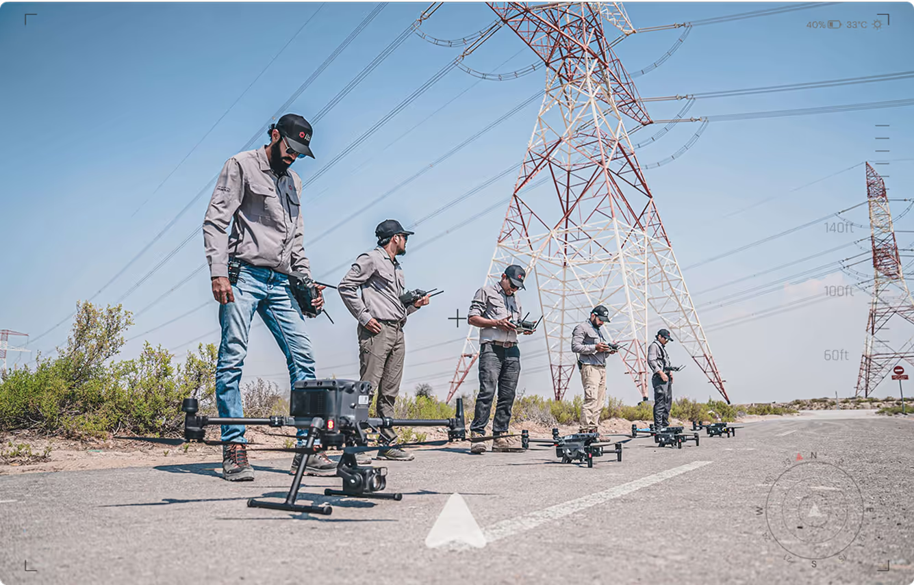
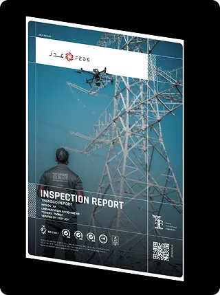
Identify critical issues with experienced engineers, inspectors and drone professionals trained to spot problems others miss. Our operators deliver high-quality data collection and reliable inspection reports that support efficient maintenance and reduce unplanned downtime.
Track project development with systematic data collection and standardized reporting protocols. Our consistent approach eliminates inaccurate reports and reduces the rework cycles that increase project costs.
How It Works
Submit Project
Requirements

Tell us your aerial data needs and timeline. We handle permit applications and regulatory requirements.
Deploy Expert
Teams

Drone pilots arrive with professional equipment and proven workflows for your project.
Deliver Professional
Results
Receive accurate data, detailed reports, and actionable insights on schedule.
Scale as
Needed

Add coverage areas or specialised services as your project requirements evolve.
Where Grounded Plans Quietly Took Flight
From delays to seamless execution — see how our drone solutions helped businesses rise above roadblocks.

.webp)


FAQs
Get quick answers to common questions about our drone operations, permits, data formats, timelines, and regional coverage. Learn how FEDS ensures compliance, speed, and data security across every project.
FEDS manages all required commercial drone permits, airspace authorisations, and DCAA/GCAA/GACA regulatory approvals across the UAE and KSA. We work closely with aviation authorities, and all pilots are licensed, insured, and certified to current standards.
Most drone projects can begin within 14 business days. In complex airspace or high-security areas, permit approvals may extend timelines to 3–4 weeks. We manage the entire process, from documentation to approvals, ensuring a smooth start.
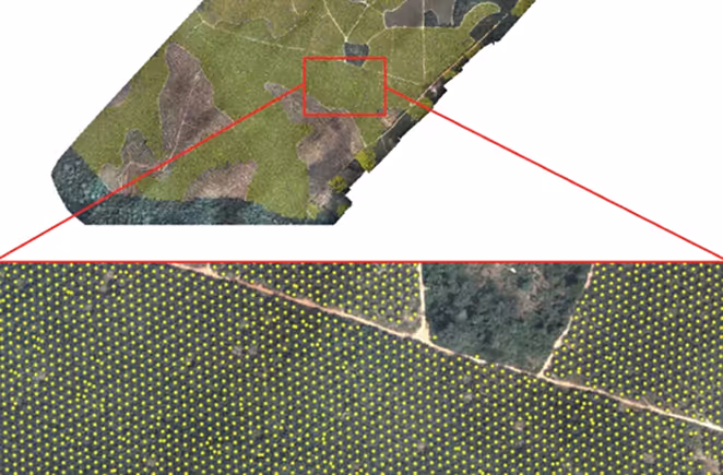
We deliver high-quality aerial data in standard formats tailored to your requirements. Outputs include: orthomosaics, NDVI/NDRE maps, 3D point clouds, DSMs, 3D models, contour lines, georeferenced imagery, Mapbox tiles, RGB and thermal imagery, survey-grade measurements, and custom GIS-, CAD-, and BIM-compatible reports.
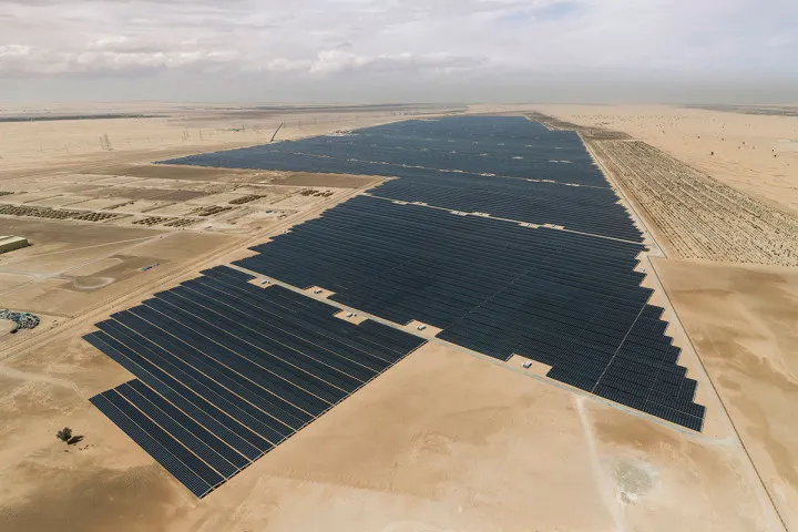
Yes. FEDS has a dedicated team and office in Saudi Arabia (KSA), enabling full-service drone operations across the Kingdom. We operate under GACA regulations and manage everything from permit acquisition to execution for sectors like power, infrastructure, agriculture, oil & gas, and government projects.
FEDS is proud to be the first ISO-certified drone company in the region, ensuring top-tier data security and operational standards. Project data is encrypted end-to-end, transferred via secure platforms, and handled in full compliance with government and enterprise policies.
Yes. For time-sensitive missions such as disaster response, infrastructure incidents, or urgent inspections, we can deploy certified teams within 24–48 hours, depending on location and permit requirements.
We use secure cloud platforms or your preferred delivery method. Data can be integrated directly into GIS/CAD platforms, project management tools, or custom dashboards. Access controls and version tracking ensure transparency, security, and collaboration.
Absolutely. We help enterprise and government clients build internal drone programs, from SOPs and workflows to training frameworks and hardware/software procurement, leveraging our deep industry knowledge and ISO-accredited systems.
Yes. Through our Drone Academy, we provide tailored workshops and operational briefings to help your internal teams interpret drone data, apply best practices, and integrate seamlessly with our deliverables.
Yes. We offer tailored monitoring plans for recurring needs like construction progress, infrastructure inspections, and compliance reporting. Our standardised data capture protocols ensure consistent accuracy over time.


.webp)