
LAST UPDATED
February 3, 2026
READING TIME
10
Min
Site teams often make decisions with outdated maps, mixed coordinate systems, and notes from earlier visits. This costs time, adds rework, and increases risk. Using drones to collect GIS data, on the other hand, helps teams replace outdated basemaps with current, georeferenced layers captured in a short flight window. This reduces return visits and gives engineers and GIS leads a dataset they can measure, audit, and reuse. As GeoAI and geospatial analytics become more common, project briefs and handover packs now require stricter standards for metadata, coordinate control, and documented accuracy.
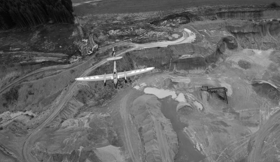
Traditional data capture often spans multiple visits. Crews collect points, return to fill gaps, then repeat checks when the site changes. Drone capture compresses field time into a short flight window. Teams then extract distances, areas, and change checks from the office dataset, where it is faster to repeat measurements and log decisions.
This benefit is most evident when teams schedule regular aerial surveys & mapping for fast-moving sites. A repeatable flight plan makes it easier to compare updates across weeks, rather than relying on photos taken from different angles and heights.
Many sites have areas that slow down ground teams: steep embankments, active traffic edges, unstable ground, or restricted access zones. Drone capture reduces time spent near these features by collecting imagery and surface data from above. That lowers exposure and reduces the need for temporary access arrangements. Any follow-up ground checks can be planned as targeted visits rather than broad site inspections.
Accuracy is not a promise. It is a target that depends on how you plan the capture and how you verify the result. Use recognised accuracy language and a verification method that matches the deliverable. The ASPRS Positional Accuracy Standards set out how to assess and report positional accuracy for digital geospatial data products. For USGS-aligned LiDAR and elevation work, USGS notes how updated ASPRS terminology affects specification language and reporting.
In practical terms, accuracy improves when teams control the inputs and document checks by:
● Using GCPs and/or checkpoints measured to a higher accuracy than the target product
● Applying Real-Time Kinematic (RTK) or Post-Processed Kinematic (PPK) correctly and documenting the workflow
● Setting flight height and overlap to meet ground sampling and tie-point needs
● Running processing QA checks and recording results
Research published in the ISPRS Archives notes that RTK and PPK play a key role in improving UAV photogrammetric accuracy. This is also why drone land surveys work best when the scope includes a clear accuracy requirement and a documented check method, rather than relying on “best effort” capture.
A high-quality drone dataset supports office-based decisions without additional manual cleanup. The goal is to convert raw imagery into GIS layers with reliable metadata and a clear coordinate reference.
First, it helps to know what “GIS-ready” means in practice. It usually refers to outputs that can be placed into GIS software as layers, measured, and compared against existing data without guesswork.
Common outputs include:
● Orthomosaic imagery for basemaps
● Point clouds for 3D measurement
● Digital Surface Model (DSM) surfaces for height and slope work
● Contours derived from the surface model
Teams that commission aerial surveys and mapping often capture the maximum time savings when deliverables include consistent naming, clear coordinate reference information, and a brief quality summary stating how accuracy was verified.
Cost savings usually come from fewer field hours and fewer return visits to fill gaps. When teams capture a complete, georeferenced dataset early, more measuring and checking moves off-site. Studies of RTK-enabled UAV photogrammetry workflows for mapping reports have reduced fieldwork time compared with traditional approaches, while still requiring independent checkpoints for validation.
This is also where drone land surveys support better cost control. When accuracy targets and deliverables are defined early, survey work becomes more predictable, reducing the likelihood of unplanned site returns or additional field days later.
Trust improves when the method’s limits are stated plainly.
Drones can struggle when:
● Vegetation obscures the ground surface
● Uniform textures reduce tie-point matching.
● Airspace limits affect flight timing or coverage.
● Tolerances require more ground verification.
Research on combining UAV photogrammetry with LiDAR shows why a mixed approach can improve results across different terrain and vegetation conditions.
It is important to state these limits in the scope so procurement and delivery teams can choose the right method up front:
● Use LiDAR or ground checks where vegetation obscures the ground surface.
● Expect weaker results on uniform textures unless you adjust capture settings.
● Build airspace constraints into the programme.
● Set tolerances that reflect how the data will be used, then verify with checkpoints.
Set accuracy in the project brief. Do not assume it. Define horizontal and vertical targets, then specify verification using independent checkpoints. This approach keeps the dataset measurable and repeatable, helping teams to trust the outputs when reviewing changes or validating measurements off-site.
Turnaround time is typically measured in days, depending on site size, accuracy targets, and processing requirements. A clear flight plan and a defined coordinate reference system reduce delays. Quality checks and an accuracy summary help teams use the layers sooner, without extra time spent fixing alignment issues. Deliverables that require dense point clouds or large mosaics can extend processing time.
Drone capture can produce georeferenced outputs with consistent metadata and coordinate reference information. When processing includes documented quality checks, teams can load the layers into GIS, measure features, and compare updates over time. The result is fewer manual fixes and fewer follow-up visits to confirm details.
Next Steps for Drone-based GIS Capture
At FEDS, we work with project teams to plan drone land surveys and mapping flights to meet clear accuracy targets and deliver GIS-ready deliverables. Where required, drone filming services can be coordinated alongside survey flights without compromising mapping accuracy or data integrity.
Contact us to discuss your site and data requirements, and how drone-based GIS data capture can support confident planning and reporting.


.webp)