
LAST UPDATED
May 20, 2026
READING TIME
10
Min
For decades, the standard protocol for inspecting industrial confined spaces has been a battle against safety and time efficiency. To check out a pressure vessel or a municipal sewer for degradation, we place personnel into harsh environments that have poor visibility, toxic fumes, and other hazards. Additionally, It required weeks of scaffolding, hazardous entry permits, and extreme physiological risk.
Today, advanced collision-tolerant drones have completely rewritten that reality. But executing a successful confined space inspection is not as simple as flying a consumer drone into a dark hole. It is a highly tactical, multi-stage operation that requires navigating complex physics, hostile environment, zero-visibility and GPS-denied locations.
Here is an inside look at the operational workflow of how we capture millimetre-accurate data in some of the most challenging environments in the world.
Before propellers spin, the mission begins with a thorough environmental assessment. Operating inside confined spaces presents a unique physical barrier: the Faraday cage effect. When a drone flies into a massive steel oil tank or a reinforced concrete silo, the structure instantly blocks all GPS satellites and severely degrades radio control signals.
To counteract this, our pre-flight planning involves mapping signal propagation routes. We plan strategic entry points and, when necessary, deploy signal repeaters or drop-nodes to ensure uninterrupted telemetry between the pilot and the Unmanned Aerial Vehicle (UAV). We also conduct a strict atmospheric assessment, ensuring the environment is safe from flammable gases that could be ignited by a drone’s electronic components.
Confined spaces are inherently dusty and could have elements that could be easily disturbed by airflow. When you introduce a drone's rapidly spinning propellers into a boiler or a mine shaft, it instantly whips up years of settled soot, dust, and rust.
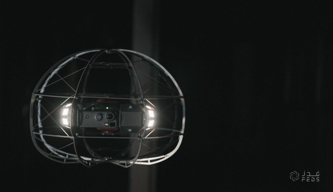
If a drone uses standard, forward-facing headlights in this environment, it experiences "backscatter" - the light reflects directly off the dust particles and blinds the camera lens, much like turning on your car's high beams in a thick fog. To prevent this, our pilots calibrate oblique lighting systems. By casting light at a distinct angle from the camera lens, the drone penetrates the dust curtain, capturing crystal-clear 4K visual data and thermal imaging without blinding its own sensors.

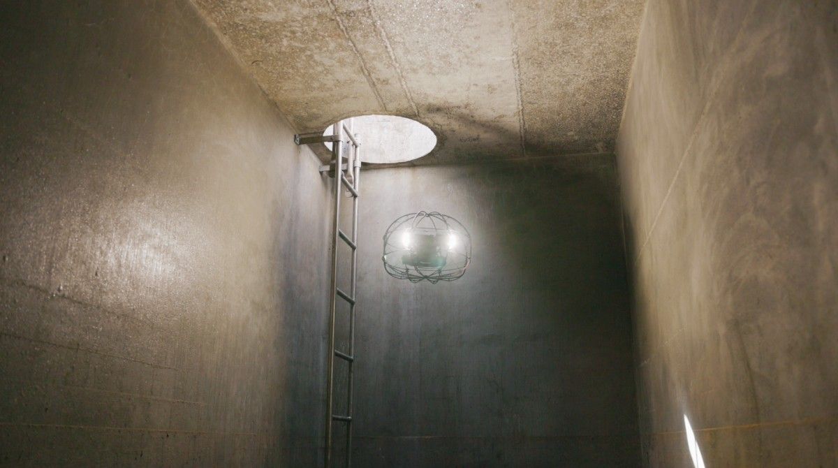
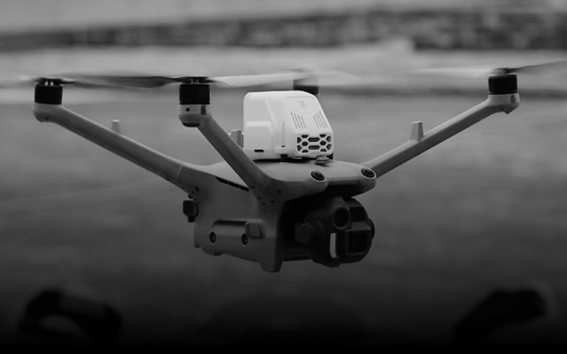
Once inside, the pilot must navigate a labyrinth without the safety net of GPS. We utilise drones built with collision-tolerant carbon-fiber cages (such as the Flybotix ASIO X) designed to intentionally bump and roll along ceilings and walls.
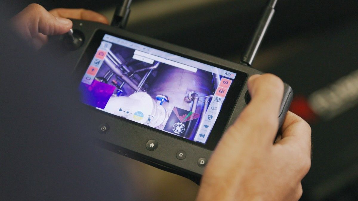
Because the drone cannot rely on satellites, it uses SLAM (Simultaneous Localisation and Mapping). As it flies, onboard LiDAR sensors pulse hundreds of thousands of lasers per second, building a 3D map of the darkness in real-time.
However, uncommon environments present unique challenges. In a perfectly smooth, featureless water tank, standard visual sensors can suffer from "drift," losing their sense of space because there are no reference points. Our pilots are trained to leverage LiDAR point clouds to lock the drone's position in mid-air, allowing structural engineers to watch a stabilised, live HD feed and direct the pilot toward microscopic hairline fractures or weld anomalies.
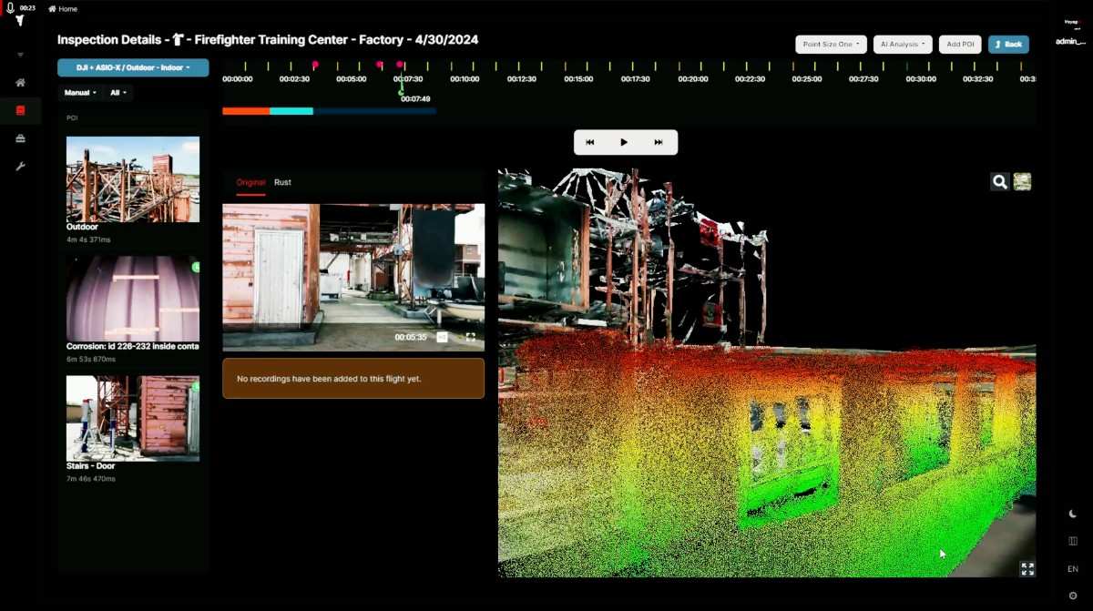
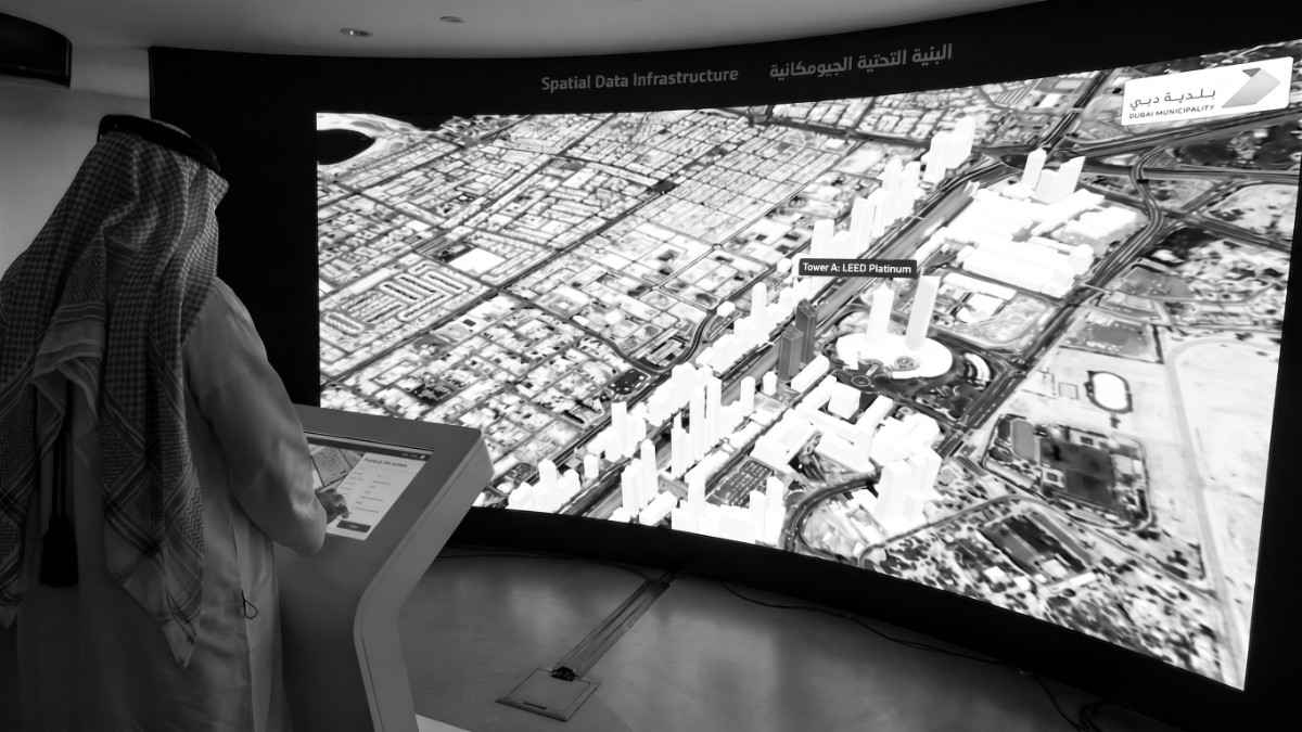
Raw imagery is fed into capable photogrammetry engines. Thousands of images and laser data points are stitched together to create a "Digital Twin"—a perfect, navigable 3D replica of the asset. This allows maintenance teams to virtually walk through a previously inaccessible ballast tank or ore pass from the safety of their offices.
This workflow remains structurally consistent, but the data we extract solves wildly different problems depending on the industrial sector.
In petrochemical refineries and maritime shipping, downtime of a few hours can cost thousands, and days can cost millions. Inspecting a ship’s ballast tank or a refinery’s pressure vessel traditionally requires extensive degassing, purging, and scaffolding.
By sending confined space drones into these metal labyrinths, we bypass the "hot work" permits. We instantly detect coating degradation, pitting, and weld stress, drastically accelerating Class Society certifications and turnaround times.
Coal, gas, and biomass boilers are massive thermal voids filled with miles of tightly packed, light-absorbing cooling tubes. Our drones illuminate these spaces, detecting slag buildup and micro-fissures in the piping. By pinpointing the exact 3D coordinates of a failing tube, maintenance crews know precisely where to cut and replace, rather than wasting days searching for the leak.
Municipal sewers and deep-water aqueducts suffer from Microbially Induced Corrosion (MIC). Hydrogen sulfide gases naturally occur in these environments, feeding bacteria that excrete sulfuric acid, which quietly damages the concrete. We fly our drones into these pipes and other assets to map structural spalling and root intrusions, keeping human inspectors entirely out of the biohazard zone.
The era of risking human lives to evaluate the integrity of confined spaces is coming to an end.
By integrating specialised confined space drones into your HSE and maintenance workflows, you eliminate the guesswork of scaffolding and the peril of toxic atmospheres. You replace human vulnerability with millimetre-accurate digital twins, proving that the safest way to inspect the unknown is to never step foot inside it.
Reach out today to book a comprehensive live demonstration and see how we can eliminate downtime and operational setbacks from your next confined space inspection.


.webp)