
LAST UPDATED
July 3, 2026
READING TIME
10
Min
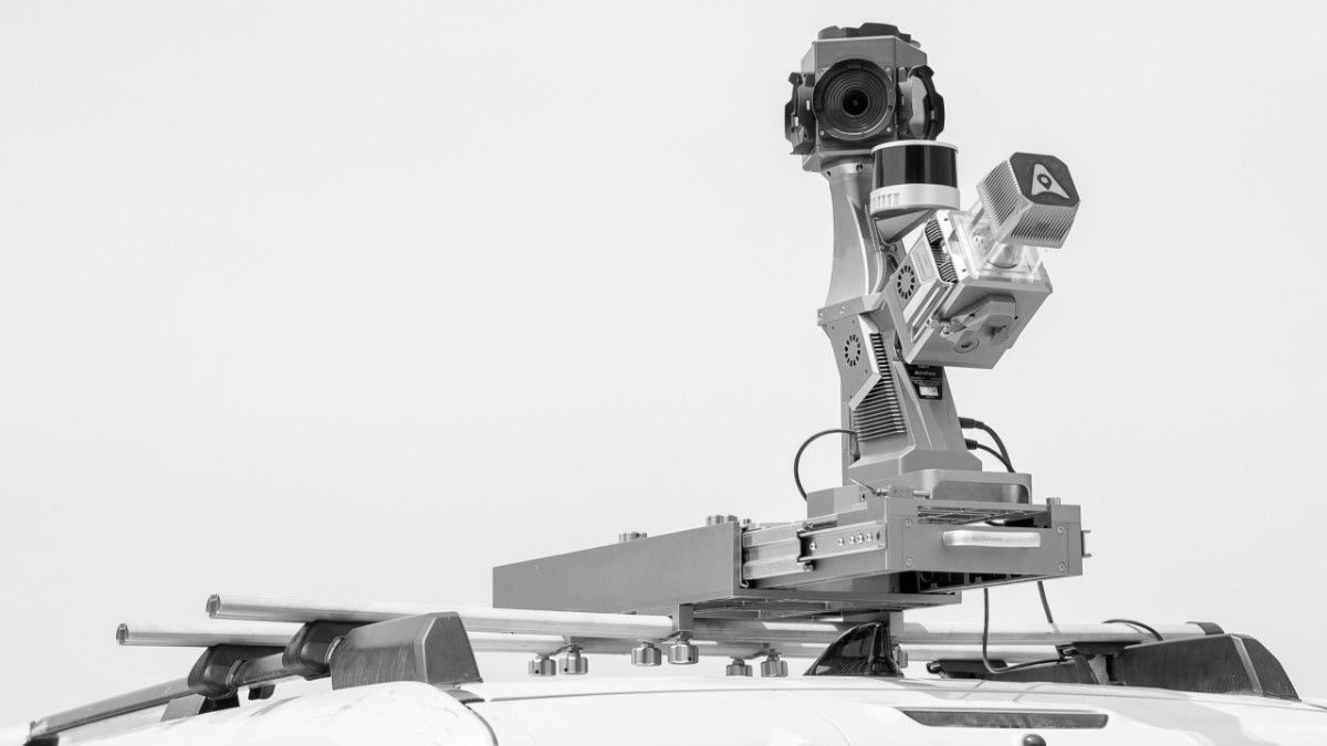
Across Dubai, Abu Dhabi and Sharjah, large-scale infrastructure surveys are shifting from tripod-based fieldwork to vehicle-mounted capture. Vans fitted with LiDAR scanners, cameras and GNSS units now record road, utility and rail corridors at normal driving speed, producing georeferenced point clouds in place of manual ground surveys.
The method, known as mobile LiDAR mapping, is evolving rapidly, and UAE adoption has accelerated sharply over the past three years. Smart city programmes, asset monitoring initiatives, digital twin projects and early-stage autonomous mobility work are driving demand, while a growing roster of regional survey and geospatial firms taking on the technology is pushing adoption further still.
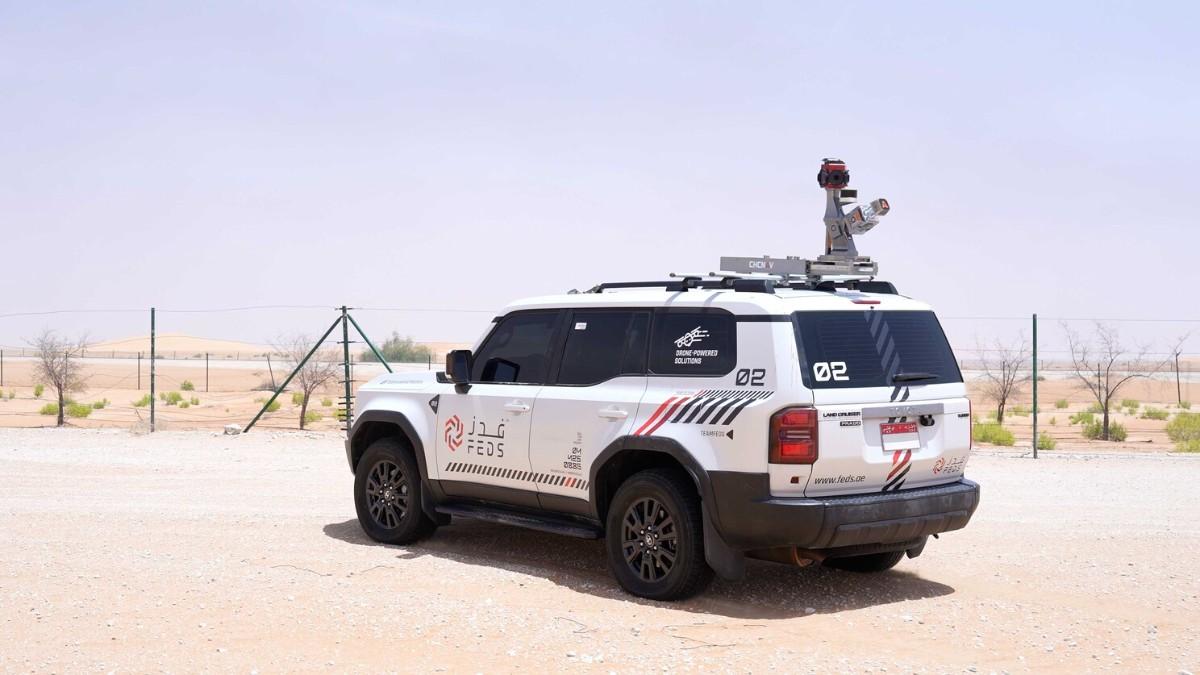
A mobile mapping unit is a vehicle fitted with a LiDAR scanner, panoramic cameras and a GNSS/inertial navigation system. It records millions of points per second, building a three-dimensional point cloud of everything in range: kerbs, signage, pipelines, overhead cables, building façades. The cameras capture synchronised 360-degree imagery, and the navigation unit geolocates every point, producing a fully georeferenced dataset.
The output is a georeferenced point cloud alongside a structured asset inventory, processed and delivered in formats compatible with standard engineering and survey software. After processing, the system maintains positional accuracy within two centimetres, meeting highway-grade survey requirements, including in the high-heat and dense urban environments that characterise most UAE infrastructure sites.
Large-area mapping across the UAE relied on ground surveying or aerial photogrammetry, each commissioned project by project, until laser scanning began targeting specific engineering problems that traditional methods couldn't solve, including structural monitoring of tall buildings and surveying active dredging works. Mobile mapping is the most recent addition to that toolkit, and its growth has tracked the UAE's wider geospatial and smart city push rather than developing as a standalone commercial trend.
Space42 has signed a long-term agreement with Dynamic Map Platform to supply LiDAR-based HD map data for advanced driver-assistance systems in the UAE and is separately building a Sovereign Mobility Cloud with Microsoft, a platform designed to handle mobility and geospatial data under UAE regulatory and data-residency requirements. Dubai Municipality joined the International GNSS Service last year to tighten the positioning accuracy behind its own survey and urban development work.
Along with mobile mapping, these programmes depend on the same high-frequency, centimetre-level ground data from a range of capture methods, and as the applications scale, so does the gap between operators who can deliver that data to a consistent, survey-grade standard and those who cannot.
Analysts at Intellectual Market Insights value the global LiDAR market at approximately USD 3.27 billion in 2025, projecting annual growth above 30 percent through the early 2030s, and they specifically identify Gulf infrastructure programmes in the UAE, Saudi Arabia and Qatar as a driver of that growth.

Mobile mapping addresses the speed and consistency limitations of conventional corridor survey directly. A corridor that would take a ground crew several days to survey, accounting for entry permits and repeat visits, is typically captured in a single drive, cutting personnel exposure on live carriageways and in direct sun in the process. Vehicle-based mapping also operates under a lighter approval framework than aerial survey, making it a practical option for sites and corridors where getting airborne is not straightforward.
Utility operators use it to track line sag and vegetation encroachment along power corridors without taking lines out of service, while road and transport authorities apply the same method to highway and rail corridor surveys spanning multiple kilometres in a single pass. Urban planning and asset management teams have started feeding the output directly into BIM workflows that previously relied on slower, fragmented data collection, a shift that has pushed UAE-based survey and geospatial firms, like FEDS Group, to add vehicle-mounted LiDAR to their service lines.
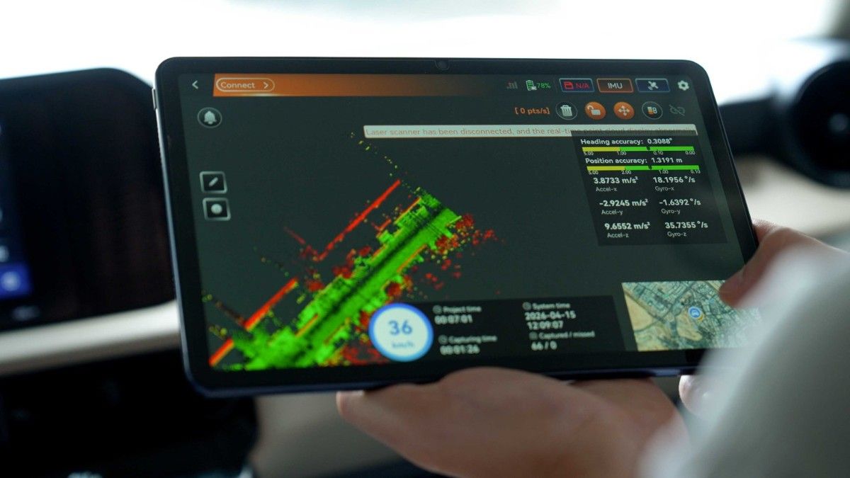
Mobile mapping's role is set to expand well beyond individual survey projects. Digital twin platforms across Dubai and Abu Dhabi are built to draw on exactly this kind of continuously updated ground data to model entire cities in real time, and autonomous mobility programmes need the same centimetre-accurate captures to build the HD maps self-driving systems depend on. The common thread across utility networks, transport authorities and master developers is the same: site data that is refreshed continuously rather than captured once and filed away.
That requirement is what moves mobile LiDAR mapping from a survey method to core infrastructure. What started as a faster way to capture a single road corridor is on track to become the baseline for how the UAE plans, builds and operates its cities over the next decade.
FEDS delivers mobile mapping as part of an integrated aerial, ground and marine survey service across the UAE, combining aerial mapping, vehicle-mounted LiDAR, land survey, bathymetric survey and handheld scanning, all delivered as a single, consistent dataset rather than separate outputs from separate vendors.
For corridor surveys, infrastructure capture or sites where drones can't reach every layer, our team can scope the right approach before your next project starts. Get in touch today.
💬 WhatsApp Us: +971 52 120 4356




.webp)
